


There is a series of seven gorgeous pearls, Kaštele on the coast of Kaštela Bay. Former settlements by the sea were protected from the Ottoman conquests by castles. The first such planned castle was built in 1480 in the Field of Kaštela by Koriolan Cipiko, commander of the Venetian galley. After he returned from the Levant in 1474, from the war with the Turks, the Prince of Trogir approved construction of a fortress for defence purposes. The distinguished nobleman surrounded the settlement with ramparts, towers and a moat over which a drawbridge led to the entrance. So, during the 15th and 16th centuries in order to protect inhabitants who were often abducted or killed by the Turkish invaders, and thus ensure production, the noble owners of the land between Split and Trogir, built 12 fortified settlements with 17 castle-forts on the 18-kilometre long coast from which the whole area got its name - Kaštela. In its hinterland, the plain of Kaštela field gradually rises towards the Trećanica massif, which closes it on the northwest side. The highest peak of this hill is Velika Trećanica, at a height of 600 metres. In the south, it is surrounded by the settlements of Plano, Rudine, Sadine and Trećanica, and its trademark is an olive grove planted in 2003, which was then the largest in Dalmatia.
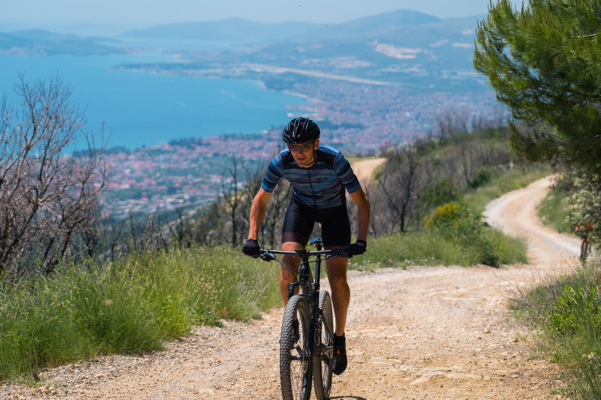
A long ascent with a gentle slope and a surface of fine macadam characterises this trail. The length of 19.7 km and a difference in altitude of 506 m make it moderately physically demanding, but its technical character is very tame, making it possible to ride the entire trail on a gravel or trekking bike, with increased caution on certain sections. It starts with a gentle asphalted descent, which later turns into a 2 km long climb with an average slope of a gentle 3.5%. The main climb starts at the 6th and lasts until the 12th kilometre, and with an average slope of 4.7%, taking you up to 270 metres above sea level on fine macadam. While climbing you can enjoy frequent views of the sea. The descent that begins at the 11th kilometre is technically mild, but there is a kilometre of rough macadam on one part that MTB will overcome with ease, while gravel and trekking bike riders are advised to approach with caution. The third, 1.4 km long climb with an average slope of 7.9%, is the most demanding part of the trail, but after it you have plenty of time to rest, as a flat section awaits you followed by a descent to the end of the trail. The initial part of the descent is the steepest with a slope of -17% and is ridden on macadam, while the rest of the descent is on an asphalt road.


**Arias Under the Stars** August 16, 2024, Friday, 9:00 PM Kaštel Stari, Brce Free admission Enjoy a magical...
Turistické sdružení města Kaštela pořádá tři kostýmované komentované procházky (storytelling) na různých...

Villa Nika, Kamberovo šetalište 30
21216 Kaštel Stari, Hrvatska


